
At the heart of any modern state lies its ability to guarantee mobility. Roads are not mere infrastructure – they are the arteries through which constitutional rights, markets, economic activities, institutions, healthcare, education, and democratic life flow. National highways in particular embody the sovereignty of the Union of India – they bind borderlands to the national core, integrate diverse populations into a shared economic and civic space, and ensure that citizenship is not geographically tiered.
In Manipur today, this foundational principle has collapsed.
When a government announces massive infrastructure projects, the narrative usually writes itself – development, connectivity, regional uplift, progress, national integration. In India’s Northeast today, particularly in Manipur, this script is being repeated with confidence. Multi-crore highway expansion plans, greenfield alignments, and a brand-new National Highway skirting the Indo-Myanmar border are being celebrated as a “transformational leap.” The Union Minister of State for Road Transport & Highways recently announced that by 2027, Manipur’s road network will be overhauled with an investment of Rs. 12,000 Crores. Another announcement declared the 658-km Indo-Myanmar Border Road connecting Mizoram, Manipur and Nagaland as a new National Highway, promising connectivity, trade, and strategic depth.
But beneath these announcements lies a paradox or rather, a profound contradiction.
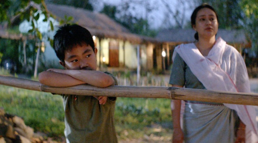
The National Highways that already exist inside Manipur- NH-37 (Imphal-Silchar) and NH-2 (Imphal-Dimapur) – are not functional as national highways for a large segment of Manipur’s population – the Meiteis. For more than two and a half years since the violent conflict broke out on May 3, 2023, these highways have been racially, territorially, and militarily regulated, rendered inaccessible by buffer zones, de-facto borders, and armed control by Kuki-Zomi militant groups, all under the watch of Central Security Forces. In the name of preventing clashes, these buffer zones have hardened into invisible frontiers.
The announcement of new highways therefore reads not as a vision of integration, but as a political instrument deployed over the ruins of a divided landscape.
This write-up argues that the government’s flurry of highway announcements, particularly at a moment when existing National Highways are closed to Meiteis, reveals the politics of the National Highway itself in contemporary Northeast. The National Highway – once a constitutional symbol of shared space – has become a bargaining chip, a territorial marker, and even a boundary between ethnic domains. Its functioning or non-functioning reflects the deeper architecture of a frozen conflict, in which silence is mistaken for peace and separation is mistaken for stability.
The Grand Announcements: New Roads to a New Future?
When Union Minister of State for Road Transport and Highways, Ajay Tamta arrived in Imphal and spoke of “transformational connectivity,” on November 12, 2025 told the media persons that 747 kilometres of the state’s 1,774-kilometre national highway network has been upgraded and blacktopped, with many single-lane roads widened to two-lane standards. The remaining 332 kilometres will be finished by the 2026-27 financial year.
He highlighted three major corridors – Imphal to Jiribam (NH-37), Yaingangpokpi to Finch Corner (NH-202), and Tamenglong to Mahur (NH-137) – along with the Churachandpur to Tuivai and Maram to Peren routes are scheduled for completion by 2025-26.
It was also mentioned that the Imphal-Jiribam highway, regarded as Manipur’s economic lifeline, has seen 152 kilometres already blacktopped and will be fully upgraded by next financial year.
Another three major routes connecting Nagaland – Ukhrul to Jessami (156 km), Mao to Imphal (97 km), and Maram to Peren (104 km) – were highlighted as being upgraded from single-lane to two-lane standards.
Ongoing preparation of NHIDCL detailed project reports for additional highways, including a 262-kilometre stretch from Churachandpur to Tipaimukh (NH-02) and a 57.91-kilometre four-lane greenfield alignment from Mao to Senapati was also announced.
It was also announced that the detailed project report for the Imphal to Moirang four-laning project is in final stages of alignment approval with the state government.
And the marquee project, the 658-km Indo–Myanmar Border National Highway, a road that would run along the border, connecting Mizoram, Manipur, Nagaland, and eventually Myanmar.
The fanfare was loud; the photographs in the NHIDCL website bright. The narrative constructed was clear – the Centre is building roads to strengthen the Northeast particularly Manipur, promote trade, improve border security, integrate tribal hinterlands, and fuel India’s Act East Policy.
Yet absent from every press release and every press briefing was the fact that NH-2 and NH-37 – Manipur’s two lifelines – remain effectively inaccessible for Meiteis, the community living in the valley. These are the two highways through which food, medicine, fuel, LPG, and almost all essential goods enter Manipur. They are the two highways that bind Manipur to Assam and Nagaland. They are the arteries through which students, patients, traders, workers, and families travel.
Their paralysis is therefore not a small thing – it is a constitutional failure.
The National Highways That Cannot Function Like National Highways
Since May 2023, the landscape of mobility in Manipur has been dangerously altered.
NH-2 (Imphal–Dimapur): The highway is blocked at Kangpokpi, a Kuki-Zomi dominated district where Meiteis are prohibited from crossing buffer zones enforced by Central Forces. Vehicles with Meitei passengers are routinely turned back. Even emergency medical travel cannot proceed.
NH-37 (Imphal–Silchar): The second lifeline is blocked at Keithelmanbi, where Meiteis are again stopped by Central Forces citing “security concerns.” Attempting to cross the buffer zone risks either interception by forces or attack by armed groups.
AH-1 (Imphal–Moreh): The Asian Highway leading to Myanmar – the jewel of India’s Act East vision – is blocked at Pallel. Moreh is under total Kuki-Zomi control, and Meiteis have been driven out.
Imphal–Ukhrul: Manipur State Transport (MST) bus ferrying journalists to cover the inauguration of the Shiroi Lily Festival by the Governor of Manipur Ajay Kumar Bhalla was stopped by Central Forces at Yaingangpokpi.
The absurdity: This means a Meitei citizen cannot:
- Travel to Nagaland
- Travel to Assam
- Travel to Moreh
- Reach half of their own state
- Access many government offices
- Drive on highways designated “national”
- Visit ancestral villages in hills
- Even cross buffer zones that run through their own districts
The result? The Manipur Valley has become a cage, a sealed enclave surrounded by impassable lines. Meanwhile, the hills – controlled by different combinations of Kuki-Zomi militant groups, village volunteers, and security forces – have become separated domains, enforced by barriers that were originally meant to be temporary.
Buffer Zones: From Neutral Lines to Ethnic Borders
The most important phenomenon reshaping Manipur is the rise of the buffer zone as an instrument of governance.
Originally, buffer zones were intended to be temporary military measures – to prevent clashes between Meitei and Kuki-Zomi communities during the violent chaos of 2023.
Today, buffer zones have hardened, expanded, and acquired political meaning, become de-facto borders.
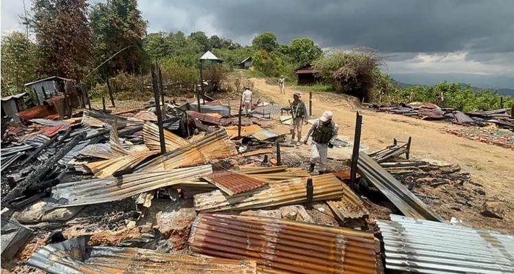
Villages like Phougakchao Ikhai, Torbung, Pallel, Kangchup, Kanglatongbi, Pukhao, and Gwaltabi now lie on opposite sides of silent frontiers. Central Forces regulate who crosses. Most displaced Meiteis are not allowed to return to homes now lying behind buffer lines.
A buffer zone is now – a mobility regulator, a territorial marker, a political statement, a punishment for one community, a shield for another, a border by stealth.
When the Kuki-Zo Council (KZC) declared on 15 September 2025 – “No free movement will be permitted. No one from either side must cross the buffer zone under any circumstances.” it was not speaking about a temporary arrangement. It was speaking like a quasi-political authority asserting jurisdiction over a permanent frontier.
And it is Central Security Forces – not local institutions – who enforce these lines.
The irony is stark – India is building a National Highway along the Indo–Myanmar border while tolerating the creation of internal borders inside Manipur.
The Frozen Conflict: When Silence Becomes Infrastructure
Manipur today is not at peace; it is frozen.
The term “frozen conflict” is typically applied to post-war regions in Eastern Europe such as Transnistria, Abkhazia, or Nagorno-Karabakh – places where violence subsides but political resolution is absent, and where armies or peacekeepers regulate movement.
Manipur fits this model with eerie precision:
- Over 61,000 IDPs still cannot return home.
- Villages burned remain unreconstructed or occupied.
- Buffer zones divide the state like cartographic scars.
- Highways remain selectively open.
- President’s Rule centralises governance and reduces accountability.
- Security forces enforce separation, not reintegration.
- Militant groups under SoO (Suspension of Operations) consolidate territorial control.
- Parallel administrations emerge in Kuki-Zomi dominated districts.
- Economic life in the valley collapses due to highway closures.
A conflict is frozen when:
- Mobility stops.
- Displacement becomes semi-permanent.
- Barriers replace negotiations.
- Roadblocks become the new normal.
- The state rules through containment rather than reconciliation.
Manipur’s frozen conflict is not accidental – it is the product of policy choices.
Highway Announcements in a Frozen Landscape: The Performative State
New highways, new alignments, new DPRs, new budgets – these make excellent headlines. But in a frozen conflict, they serve a purpose different from development. They become:
- Narrative tools to signal progress
- Political devices to demonstrate control
- Instruments to pacify certain constituencies
- Ways to signal to foreign partners that India’s Northeast is stable
- Methods to bypass the reality of internal paralysis
In Manipur, the more the highways are blocked, the more the government announces new highways.
This is infrastructural performance: heavy symbolism, low impact.
The paradox is blunt – How can the government build a brand-new National Highway along the Indo–Myanmar border when citizens cannot use the National Highways within Manipur itself?
What good is a greenfield four-lane route between Mao and Senapati when the Meitei population cannot even pass Kangpokpi?
What does a Rs. 12,000-crore highway upgrade mean when basic freedom of movement does not exist?
Highway announcements have become a political substitute for political courage.
The National Highway as a Political Instrument
NH-2 and NH-37 no longer function as public goods. They function as political assets.
Control over highways determines:
- Who enters whose territory
- Who controls trade
- Who controls taxation and extortion
- Which group controls the narrative
- Which areas remain connected to India
- Which areas can economically breathe
- Whether IDPs can return home
- Whether reconstruction can begin
Thus, in Manipur – The National Highway has become the site of the conflict itself.
It is not the stage on which politics unfolds; it is the instrument through which politics is exercised.
A closed highway is a political position.
An open highway is also a political position.
A partially open highway is a bargaining tactic.
The illusion of opening is a narrative management strategy.
In September 2025, the SoO renewal ceremony in Delhi became a perfect example.
The Press Information Bureau claimed NH-2 was being opened.
Within hours, Kuki-Zo bodies contradicted the claim.
The Valley Volunteers protested.
Naga groups issued their own clarifications.
Meitei organisations denounced narrative manipulation.
The highway was open on paper and closed on the ground.
This is not a logistical failure; this is politics by other means.
The Cage and the Wall: Re-mapping Manipur Through Highways
Mapping restrictions district-by-district reveals a disturbing cartography.
The Manipur Valley (Imphal East, Imphal West, Bishnupur, Thoubal, Kakching)
Becoming a sealed enclave.
All paths out are blocked by buffer zones.
The Northern Wall: Kangpokpi
The NH-2 blockade point. A de-facto border preventing movement to Nagaland.
The Western Barrier: Noney and Tamenglong
Silent zones Meiteis rarely traverse.
The Southern Gate: Bishnupur to Churachandpur
Blocked at Phougakchao Ikhai. Even a Supreme Court judge and an MP from inner Manipur Parliamentary constituency were stopped here.
The Eastern Frontier: Tengnoupal and Moreh
Moreh is completely inaccessible to Meiteis.
Ukhrul and Kamjong
Even official government buses are stopped.
Jiribam
A fragile corridor kept alive only through security convoys and by helicopter.
Pherzawl
A sealed frontier with spillover impacts on Jiribam.
The Manipur Valley is thus surrounded by walls – natural geography replaced by artificial, militarised frontiers.
Meanwhile, the large areas of the Manipur hills are consolidated under a patchwork of Kuki-Zomi organizations, with SoO camps, village volunteers, and vigilante patrols operating with varying degrees of autonomy.
The National Highway system maps these transformations with chilling clarity.
The Constitutional Problem: Can a State Have Highways Open Only to Certain Ethnicities?
India’s Constitution does not imagine internal borders.
It does not anticipate ethnic checkpoints.
It does not sanction buffer zones in the middle of National Highways.
Article 19(1)(d): All citizens have the right to move freely throughout India.
But in Manipur, this right does not exist for all. Not in practice.
Movement is mediated by identity.
Security is mediated by buffer lines.
Rights are mediated by who controls a particular stretch of road.
This raises a disturbing question:
Is India inadvertently enabling an internal partition of Manipur?
Highways that cannot be crossed by certain groups effectively institutionalise territorial separation.
The Indian state cannot claim territorial integrity along the Indo–Myanmar border while tolerating territorial fragmentation inside Manipur.
Building Border Highways While Domestic Highways Are Broken: A Strategic Illusion
India’s Act East Policy is premised on integrating Northeast India with Southeast Asia.
But a region cannot be a gateway if:
- Its main highways are blocked
- Its capital is cut off from neighbouring states
- Its communities cannot cross into each other’s regions
- Its border towns (like Moreh) are inaccessible to its own citizens
How can India dream of opening trade with Myanmar when Manipur’s own citizens cannot travel to the border?
How can India promise security cooperation when its own internal buffer zones are controlled by non-state actors?
How can Delhi speak of regional connectivity when it tolerates internal disconnection?
Strategically, diplomatically, morally, constitutionally – the contradiction is indefensible.
Unfreezing the Highways: What Must Be Done
Restoring NH-2 and NH-37 is not a technical project.
It is not about blacktopping, bridges, or widening.
It is about the fundamental health of the Republic.
The India must:
- Restore National Highways as neutral corridors
Not ethnic corridors.
Not controlled by militants.
Not regulated by unaccountable buffer zones.
- Demilitarise buffer zones from highways
Security cannot justify ethnic segregation.
- Establish judicial oversight over movement restrictions
The right to mobility cannot be left to ad-hoc decisions by Central Forces.
- Ensure safe, escorted passage for all ethnic groups
Not selective access.
- Enable the return of IDPs through secure highway access
Without highways, return is impossible.
Without return, peace is impossible.
- Hold accountable those who restrict national highways
Including militant groups operating under SoO.
Including civil bodies issuing blockade threats.
Including any forces enforcing selective restrictions.
- Make reopening existing highways a precondition to new highway projects
A border highway is meaningless without internal connectivity.
Conclusion: Highways Do Not Lie
Highways reveal political truths.
They expose realities governments try to hide behind grand announcements.
They show the fault lines of a society more clearly than speeches ever can.
In Manipur today, the National Highways are telling a blunt story:
- A state divided
- A conflict frozen
- A population immobilised
- A geography re-drawn by force
- A Republic hesitant to enforce its own constitutional promises
New highways along the Indo-Myanmar border cannot compensate for the fact that NH-2 and NH-37 – Manipur’s lungs – are half-closed, racially restricted, militarily controlled, and politically weaponised.
A National Highway is supposed to connect citizens. In Manipur, it has become a wall between them.
Until India restores the simple, sacred promise that a citizen may travel freely within their own state, no new highway – no matter how ambitious – will lead to development, peace, or integration.
Highways must be roads, not borders. And Manipur must be a state, not a set of separated enclaves.
Only when NH-2 and NH-37 are truly open – for everyone, without buffer zones, without fear, without ethnic exceptions – will the new border highway truly connect India to the world.
Until then, these announcements are not symbols of progress. They are symbols of a conflict the government refuses to unfreeze.

Senior Editor: Imphal Review of Arts and Politics