

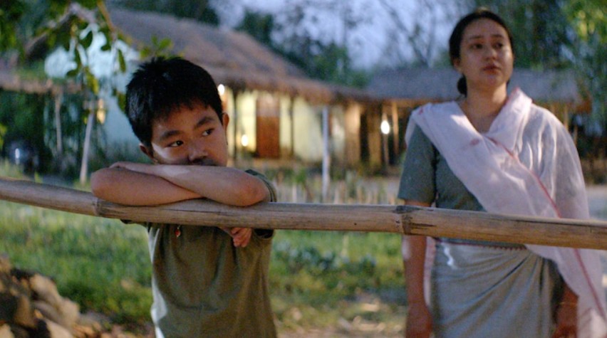
When violence erupted in Manipur’s Churachandpur on May 3, 2023 where Kuki-Zomi groups including armed militants attacked the Meiteis in Churachandpur with burning down of houses and expanded their attack simultaneously in other Kuki-Zomi dominated districts on the same night including places Moreh, Kangpokpi, Pukhao, etc. in the Valley and the hill districts; and retaliatory mobs tried to storm Kuki-Zomi colonies in Imphal, the Government of India (GOI) rushed in by airlifting thousands of Central Security Forces including Indian Army to contain the clashes between Meitei groups in the valley and Kuki-Zomi groups in the surrounding hills. The instrument of choice was the “buffer zone” – a strip of separation patrolled by Central Security Forces to prevent direct confrontation. At first, it seemed a sensible step – keep combatants apart, reduce mob violence, and create breathing space for dialogue.
Twenty nine months or 872 days later, the story looks very different. The hard fact is that these buffer zones have hardened into borders. On paper, they remain neutral spaces. In practice, they enforce a geography of separation. For Meiteis, the valley is beginning to feel like a cage; for Kuki-Zomi groups, the buffer zones act as shields behind which their political project consolidates.
The gulf between official narratives only deepens this perception. On September 4, 2025, the Union Ministry of Home Affairs (MHA) through Press Information Bureau (PIB) in Delhi declared that the renewal of the Suspension of Operations (SoO) agreement with umbrella groups of Kuki-Zomi militants – Kuki National Organisation (KNO) and United People’s Front (UPF) and the Kuki-Zo Council (KZC) has decided to open National Highway-02 for free movement of commuters and essential goods. On the same day, Within hours, KZC issued two clarifications – the highway, they said, was never closed or blocked by them; the ask was not “reopening” but additional central security to ensure safe passage “while maintaining the sanctity of buffer zones”. But just eleven days later, the KZC further issued a press note on September 15, 2025 insisting:
“KZC has not declared the reopening of NH-02. No free movement has been permitted on this route. … As there is no settlement or agreement to the conflict between the Meitei and Kuki-Zo communities, no one from either side must cross the Buffer Zone under any circumstances. … The Buffer Zone is to be respected at all costs.”
In other words, what Delhi calls “connectivity,” the KZC calls “off-limits.”
This article attempts to trace how buffer zones have redrawn Manipur’s map on the ground.
Buffer Zones: Temporary Security or De-Facto Partition?
As stated the MHA and Central Security Forces earlier, buffer zones were never meant to define sovereignty. They were supposed to be internal security lines within a single state, not markers between two distinct political entities. But on the ground, they are treated differently.
The Kuki-Zomi groups view these zones as the outer limits of their exclusive control. The Meiteis, meanwhile, are told not to cross. Central Security Forces enforce this immobilization, citing security needs.
What emerges is not just separation to prevent violence, but an implicit recognition of parallel sovereignties: Imphal Valley for Meiteis and other communities, Kuki-Zomi dominated hill districts under Kuki-Zo control.
For the Kuki-Zomi leadership, buffer zones have become a political instrument. By denying valley residents access to highways, trade routes, and government facilities in the hills, they reinforce the claim that these territories belong to a different order.
The Village Volunteers Coordinating Committee (VVCC) warned on September 5:
“The so-called reopening of NH-2 is meaningless, as valley residents remain excluded. Buffer zones have turned into instruments of division, not protection”.
This sharpening divide means that a temporary security measure now carries the political implications of partition.
A District-By-District Mapping of Manipur’s Divide
Mapping the buffer zones district-by-district, we see how measures intended as temporary and a security architecture ostensibly designed to prevent direct clashes have instead over time produced ethno-territorial quarantines and become de facto borders – and how their political use is shaping a silent partition.
Imphal West & Imphal East: The Valley Entrapment
Together with the districts of Bishnupur, Kakching and Thoubal, the twin Imphal districts form the Meitei heartland and rice bowl of Manipur. These are the only areas where Meiteis can move without much restriction. Yet even here, anxiety looms:
- The western edge of Imphal West abuts Kangpokpi, the then Sadar Hills areas of Senapati district, where buffer zones prevent valley residents from venturing further north or west.
- In Imphal East, movement towards the hill districts of Ukhrul and Kamjong is heavily restricted.
For Meiteis, Imphal has become a cage: safe inside, but ringed by barriers that make it impossible to access traditional centuries-old routes to Myanmar, Mizoram, Assam, Nagaland, or even other parts of Manipur. The GOI’s promise of “highway access” falls flat here – the highways spread out from or pass through Imphal but are cut off at the buffer zones.
Bishnupur: The Southern Gate, Now Locked
Bishnupur district once served as a southern gateway to Behiang along Manipur-Myanmar border and Mizoram’s capital Aizawl via Churachandpur, the epicentre of Kuki-Zomi politics. Today, the buffer zone at Phougakchao Ikhai is one of the most volatile flashpoints.
- Meiteis attempting to return to ancestral homes south of the buffer are stopped cold.
- Central Security Forces, officially neutral, operate checkpoints that function as one-way valves – Kuki-Zomis pass more easily while valley residents cannot go beyond Phougakchao Ikhai. Even the Supreme Court Judge and Member of Parliament belonging to Meitei community are not allowed to reach even Phougakchao Ikhai Buffer Zone.
This has produced a profound sense of siege. Bishnupur’s economy, once interlaced with trade flows from the south and neighbouring hills, now struggles. The valley’s perception of economic strangulation persists here. Every attempt to cross Phougakchao Ikhai reinforces the sense that buffer zones are less about preventing violence than about containing one community.
Kangpokpi: The Northern Wall
Kangpokpi is now the northern frontier of Meitei access – and the most telling example of the widening gap between GOI’s promises and Kuki-Zo’s prohibitions.
- NH-2, the National Highway that once linked Imphal to Dimapur, runs straight through Kangpokpi.
- On September 4, with the renewal of SoO, the MHA claimed that the KZC has decided to open National Highway-02 for free movement of commuters and essential goods. However, within hours on the same day, the KZC issued two clarifications – the highway, they said, was never closed or blocked by them; the ask was not “reopening” but additional Central Security Forces to ensure safe passage “while maintaining the sanctity of buffer zones”.
- On September 15, the KZC further flatly contradicted MHA’s claim, declaring: “KZC has not declared the reopening of NH-02. No free movement has been permitted on this route.”
For Meiteis, this is confirmation that the buffer zones have morphed into a border. The National Highway is no longer a shared lifeline; it is a corridor controlled by Kuki-Zomi groups, guarded by Central Security Forces, and closed to valley residents especially Meiteis. What was once a symbol of connectivity has become an artery of exclusion and weaponised.
Churachandpur: The Capital of the Separate Administration
If there is a nerve centre to the Kuki-Zomi demand for a Union Territory, it is Churachandpur. The district now functions as the administrative and symbolic capital of a parallel geography.
- KNO and UPF, the main SoO signatories, maintain their heavy presence and power.
- Meiteis are driven out, absent and prevented from entry and returning to their ancestral homes by checkpoints at the buffer zones.
- Valley leaders accuse Central Security Forces of enabling a Kuki-Zomi de-facto mini-state under the SoO cover.
On September 5, the VVCC rejected the supposed “reopening” of NH-2, arguing that valley residents remain excluded. For them, Churachandpur is no longer part of Manipur’s integrated map – it is the capital of a parallel administration, shielded by the very buffer zones supposedly meant to preserve unity.
Tengnoupal & Chandel: The South-Eastern Gate to Myanmar
Border districts along Indo-Myanmar International Border like Tengnoupal and Chandel were once crucial trade corridors. Moreh, in Tengnoupal, buzzed with cross-border commerce. Today, the picture is starkly different.
- Moreh is firmly under Kuki-Zomi control, with Meiteis effectively barred from entry after driven out completely.
- Meiteis are not allowed to go beyond Pallel along the Indo-Burma Road or Imphal-Moreh stretch of Asian Highway Number-1 (AH-1).
- Buffer zones here function less as lines of restraint and more as instruments of monopoly.
- Control of Moreh gives Kuki-Zomi groups economic leverage and bargaining power.
Control of Moreh grants Kuki-Zomi groups both economic leverage and bargaining power. That MHA’s PIB press releases omit this fact is telling. While the MHA talks of “restoring peace,” on the ground, control of trade routes is shaping the terms of future negotiations.
Ukhrul & Kamjong: Naga-Kuki Intersections
The story of buffer zones is not only about Meitei-Kuki separation. In Naga-dominated Ukhrul and Kamjong districts, there are some Kuki villages. Naga and Kuki groups have their own history of clashes. Here, buffer zones are maintained to prevent clashes not only between Meiteis and Kukis but also between Nagas and Kukis.
But the Imphal Valley especially Meiteis experience:
- Highways running through Ukhrul and Kamjong are blocked to valley commuters. Imphal’s isolation deepens.
- Even Manipur State Transport (MST) bus ferrying journalists and staff of the State Government’s Directorate of Information and Public Relations (DIPR) to cover the opening of the state function, Shiroi Lily Festival 2025 by the Governor of Manipur Ajay Kumar Bhalla was not allowed to go beyond Yaingangpokpi along Imphal-Ukhrul highway and stopped by the Central Security Forces.
These are not simply lines of restraint; they are lines of disconnection that sever the valley’s historical routes to north-eastward and eastward.
Senapati: A Silent Passage, Now Blocked
Senapati district lies north of Kangpokpi and is predominantly Naga. NH-2 passes through it on the way to Nagaland. But Meiteis never reach Senapati, because Kangpokpi blocks them first.
In this sense, Senapati is doubly cut off – not hostile itself, but inaccessible because the northern wall of Kangpokpi has sealed the passage. For valley residents, Nagaland might as well be another country hard to reach by the Meiteis.
Tamenglong & Noney: The Western Silence
Western districts like Tamenglong and Noney have seen less direct violence. But they are not open. Meiteis hardly risk traveling west, and security forces discourage it. This silence is telling – even where violent conflict is absent, buffer psychology prevails. The valley’s sense of confinement is not only about active clashes but about the fear of crossing invisible lines.
Jiribam: Fragile Corridor
Jiribam, on the western edge, links Manipur to Assam via NH-37. Technically, it is one of the two the valley’s lifelines to the wider world. But in practice:
- The road is long and treacherous, vulnerable to attacks and ambushes.
- Buffer restrictions and blockades make travel hazardous.
Even this corridor feels fragile. For valley residents, Jiribam is less an escape route than a tenuous lifeline that could be severed at any time.
Pherzawl: The Sealed Frontier and Jiribam’s Vulnerability
If Churachandpur is the capital of the Kuki-Zomi parallel administration, Pherzawl is its sealed frontier and stronghold of Hmar community. Created in 2016 from Churachandpur’s western hills, the district stretches deep towards Mizoram, but its immediate weight lies along its boundary with Jiribam – Manipur’s only valley district beyond Imphal Valley. What should have been a quiet borderland has instead hardened into a pressure point of the conflict.
- Buffer posts choke the roads through Parbung, Thanlon and Tipaimukh, once vital links for trade and movement.
- Meiteis are barred from entering, while even smaller hill tribes say travel depends on the discretion of security checkpoints.
- The absence of valley traders, fuel and goods signals a slow but deliberate isolation.
- SoO groups are here and their control is clear in who is permitted to move – and who is excluded.
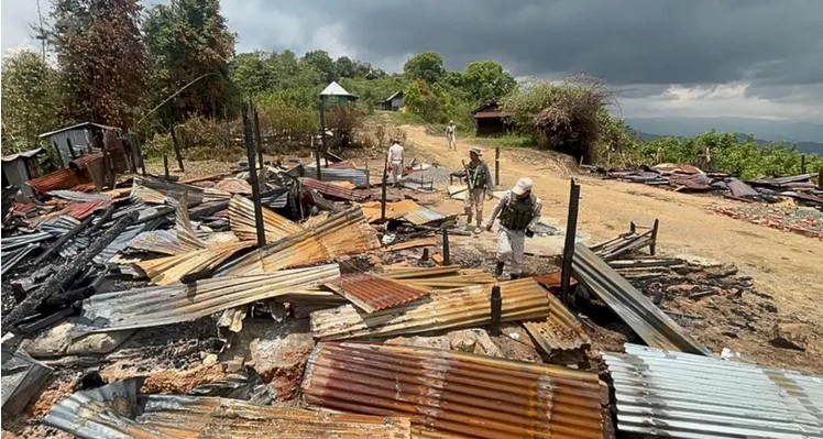
- Kuki-Zomi militants attacked the Meiteis burning down houses and killing including the kidnapping and killing of three children and three women in November 2024.
This sealed geography has left Jiribam directly vulnerable. Valley leaders argue that Pherzawl now functions as a shielded flank from which the Kuki-Zomi project can press towards northern boundary destabilising Jiribam’s fragile coexistence of Meitei, Pangal and other tribal communities. For them, Pherzawl is no distant periphery – it is the outer wall of Manipur’s silent partition, pressing upon Jiribam’s precarious future.
The Emerging Cartography: A Valley Besieged
Overlay these districts on a map and the pattern is stark:
- Meiteis are restricted to the Central Valley (Imphal East, Imphal West, Thoubal, Kakching, and Bishnupur).
- All surrounding hill districts are effectively closed.
The result is an island enclave – not by natural geography, but by enforced separation. What Delhi calls the Buffer Zones as “zones of restraint” are, in reality, zones of exclusion.
Buffer Zones as Proto-Borders
The KZC’s September 15 clarification makes one point crystal clear: buffer zones are not temporary inconveniences. They are to be “respected at all costs.” Violations, it warns, will bring “serious consequences.”
This transforms the debate. These are not fragile ceasefire lines. They are proto-borders, invested with permanence by those who enforce them. The MHA’s rhetoric of unity and integrity jars against the KZC’s insistence that no free movement will be allowed.
Together, these positions incubate a silent partition: Delhi maintains the fiction of integrity and opening of National Highway, while Kuki-Zo groups consolidate exclusion.
Legal, Political, and Constitutional Implications
Three consequences flow from this new geography:
- Administrative Entrenchment: Measures designed as temporary for security can harden into permanent arrangements. Already, buffer zones normalize exclusion. Tomorrow, they may justify new councils, autonomy, or even a Union Territory as the Kuki-Zomis demand.
- Democratic Deficit: Negotiating such changes while communities are immobilized under security watch undermines legitimacy. If valley residents cannot travel and move freely, organize, or contest, and denied the fundamental rights guaranteed under Indian Constitution, their democratic voice is muted.
- Rule of Law Concerns: Central Security Forces patrolling these buffer zones wield enormous discretionary power. Without oversight, this risks repeating old patterns of abuse. Security measures that lack accountability erode trust and deepen grievance.
Borders by Stealth: The Blunt Truth
Manipur’s geography is being rewritten willingly or unwillingly not by law, not by legislation, but by “security barricades” or “buffer zones”. The Central Valley is hemmed in, highways interrupted, exits sealed. Delhi proclaims “restored connectivity”; the KZC insists there will be none. Now, two narratives and two realities emerge – and in between, a community that feels trapped and besieged.
Buffer zones are sold as neutral safety lines. But almost two and half years on, they act as de-facto borders. They shield Kuki-Zomi militant strongholds, paralyse the Central Valley, and prepare the ground for a Union Territory demand that Delhi seems pretending not to hear.
The blunt truth is this: buffer zones are no longer just about preventing violence. They are political instruments of control. By banning both Meiteis and Kukis from crossing, they reinforce exclusive territories, deny access to National Highways, hospitals, educational institutions, markets, other government facilities, airport, and turn government facilities into fortresses.
If left unchallenged, today’s buffer zones will be tomorrow’s borders. And when that map is finally drawn, Manipur will have been partitioned, even if within the State, not by open decision, but by stealth.
The Imphal Valley knows this. The Kuki-Zomi-dominated hill districts know this. The Naga-dominated hill districts also know this. And somewhere in Delhi, so do the mandarins and ministers who keep speaking of unity and integrity of Manipur and opening of National Highways while quietly seem presiding over silent separation.

Senior Editor: Imphal Review of Arts and Politics

1 thought on “Buffer Zones Become De Facto Borders of Manipur’s Silent Separation”
So Buffer Zones have become physical borders instead of transitory administrative medium for peace restoration. While the world is moving farther away from the physical, we are going back in a very demeaning way towards the physical concept of border
Comments are closed.