Protracted Conflict and Foundations of Territoriality
“Did coloniality depart or arrive in Manipur in the postcolonial?” It was one of the two questions that I had posed at the end of an inaugural public lecture in Imphal way back in 2006. To some people, this question might generate a sense of discomfort. In fact, it did. In a response to the said lecture, a well-known public figure, who had also served as the state president of a national political party, wrote in the local newspapers then that there was no question of “coloniality” in the postcolonial Manipur, thereby India. Reiterating that we are all free citizens of a free country called India, he went on to cite the case of Mrs. Indira Gandhi, a north Indian who had fought election from south India (Chikmagalur), as a testimony, and cheekily averred that I could also stand for election anywhere in India!
Given the ambience of the decades-old armed conflict and its familiar discourses and rhetoric in the state, it seemed that he had taken the poser as a mischievous attempt to brand India as a “colonizer” and Manipur as its “colony”. Quite obviously, it is not easy to address crucial and/or contentious issues dispassionately, especially in conflict situations or polarized societies. For, in such situations, heightened sense of real or manufactured or perceived threat tends to often distort information to use the same as instruments of self-fulfilling prophecy.
One critical aspect of that tendency is de-contextualization, that is, to read and use information by discarding the context or placing it in a different context. For instance, in the above case, the nuances of the juxtaposition of “coloniality” and “postcolonial” together in the same frame of reference was lost. Or, more precisely, the context, including the intent, of the poser was discarded. That the question was to assess and take responsibility to refashion the present state of affairs rather than simply fixing blame on the others or the past was stated in the preceding lines in the said lecture as follows:
“People informed by postcolonial consciousness seem to have the confidence to engage with … predicaments. Many of them are going through critical self-appraisals of themselves and others to understand and refashion their lives. If this is the case, allow me to leave behind two questions, which I think, are crucial for us to refashion a wholesome holistic self.”
Incidentally, the other question I left at the end of that lecture, which preceded the one I have quoted at the beginning here, was, “when did “Manipur” become a part of “India”? Was it 27 April 1891 or 11 August 1947 or 15 October 1949 or any other date? Like the other question, it was to initiate a critical engagement with the way history/histories is/are written (or, pasts are talked about and understood), for such exercise have critical bearings on our sense of (collective) selfhood and the prevailing conflict situations.
I take this revisit to the said lecture to underscore the fact that similar processes can also happen with reference to the ongoing controversy over Mt. Koubru; that is, any dispassionate attempt to look at the issue can be distorted by the prevailing prejudices and mistrust. And therefore, one must guard against such distortions in order to address and resolve the issue.
There is another crucial reason as to why I take this revisit. It is to draw attention to the protracted nature of an underlying problem: the fractured nature of society and polity, and the concomitant discourses in Manipur. This fissure and the discourses around it were the central themes of that public lecture in 2006. As it stands today, we know that since then, many manifest incidents underlying the schism in society and polity have taken place. In other words, the conflict and estranged inter-community relations — lest we forget, with terrible human tragedies — have, if not aggravated, remained unchanged over the years. And more crucially, the nature of the discourses, including the ones on our pasts and histories, that informed these events have neither changed in any tangible way as well. The present Koubru controversy stands as a testimony to these stubborn facts.
Ominous Signs and Imperatives of a Holistic Approach
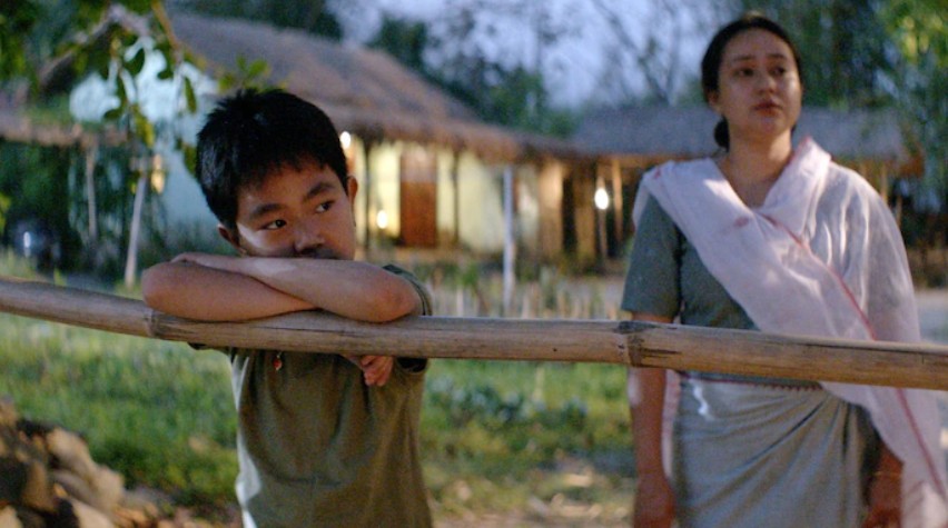
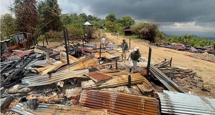
It must be reiterated that these incidents are not some news events that have simply been consigned to the pages of old newspapers or old video or still footages with blurry images in the archives. Many of these are marked by numerous human tragedies — people have been humiliated, battered and bruised, mercilessly murdered in the most gruesome manner possible or died or gravely injured in instances of orchestrated or mindless violence accompanying these incidents. This is besides the loss of properties and homes worth crores of rupees. These sufferings are parts of the memories that people have, often as added layers to form deep seated resentments and/or fueling the latent prejudices. These are the dormant stuff that (can) make people susceptible to propaganda and/or provocations or burst into violent manifestations.
That the ongoing Koubru controversy promises such an ominous prospect should not be brushed aside. For, the issue is related not only to people’s living traditions, deeply held spirituality and faiths, origin myths and mythologies but also historically rooted territorial imaginaries. It is worth reminding that these living traditions, spirituality, origin myths or mythologies etc cannot be dismissed. The rights to observe, practice and pursue such traditions are globally recognized aspects of human rights. Any contemptuous disregard or manipulations to undermine such living traditions are bound to invite conflict and violence. Unfortunately, in this regard, worrying signs have already appeared on the horizon.
During the last few months, there have been talks of religious artifacts and sites of worship at and around Mt Koubru being burned or destroyed. These are signs of an aggressive and contemptuous disregard for people’s living traditions. On the other hand, some people have begun to openly indulge in the familiar refrains of terming fellow citizens as “refugees” and “foreigners”, something that had accompanied the bloodsheds in 1990s in Manipur. No one should allow any prospect of repeating those senseless violence, those acts of innocent men, women and children being killed by dragging them out of their homes or buses. Only a sinister political manoeuvre or blind prejudices will encourage the prospect of such violence. Thus, the ominous warning bells must be taken seriously.
Given these conditions, there is an urgent need to go into the depth of the issue in a dispassionate and holistic manner. Such an approach entails us to consider the controversy over Koubru not as an isolated issue in itself but rather as an aspect of the “hill-valley divide”. At the same time, such an approach should also explore the possibility of a resolution to the controversy which is not necessarily tied to the outcome of the larger conflict. And the central task of such an exercise should be to unpack the taken for granted categories and discourses that breed conflicts and estrangements. Only then, alternative ethical and political possibilities could emerge to free ourselves from the tragedies of self-defeating discursive cycle and what it reproduces — our protracted conflicts and estrangements in the state.
Such a holistic approach entails us to avoid analyses which tend to confine to the usual domains of history, politics, culture etc. Incidentally, the much talked about “territorial integrity” in Manipur is primarily articulated from these aspects of, if one may, superstructure. A holistic approach must begin from the very physical “base”, the geological-geographical nature of the state itself. For, these geological and geographical properties mediate the evolution and nature of economic forms of life as well as socio-cultural and political character of the state. Besides, the way the state is articulated in terms of its physical characteristics sets the contours and limits of its polity. To put it the other way round, the possibility and stability of (a given or desired) territoriality depends upon the topography of a given territory.
Thus, a modicum of objective views of the topographical reality of Manipur is required in order to address the “hill-valley divide”.
Topography and Foundations of Territoriality
There are fundamental flaws in the way the topography of the state has been represented, articulated and understood (see, Part 1). These misrepresentations play a crucial part in the production and reproduction of the “hill-valley divide”. Having failed to acknowledge — or, rather by deliberately misrepresenting the fact that Manipur is a part of a mountainous region, a false dichotomy has been created between its hills and valleys by treating these two landforms as unconnected or unrelated to one another (see, Part 1). This dichotomy is further sustained by reducing the valleys into a singularity in order to fossilize human settlement patterns in terms of the concocted dichotomy.
This false misrepresentation is so deep rooted that some even debate whether Manipur is a “hill state” or not. In fact, a couple of years back, it was reported that the state government had requested the Union Government to declare Manipur as a “hill state”. It seems that no one bothers to check whether this designation is a constitutional one or an administrative category. In any case, the fact is that in the scheme of things adopted by the agencies of the government of India since mid-1960s at least, Manipur has been officially identified as one of the “hill states” (or Hill Union Territories) in the country along with its neighbouring states like Nagaland, and Mizoram. This designation is different from the other official classification of hill areas in the country, namely, the states with “designated hills areas” (such as Kerala, Assam etc).
This designation is in line with the natural features — geological and geographical characteristics — of the state. Incidentally, popular patriotic song “Khomlang laman sing-ngamloi nang-gi” refers to Manipur as “chingleipakki Ema” (My motherland, the hilly abode or the land of hills). This self-perception of the state being a Chingleipak (“hilly land” or “land of hills”) has crucial implications in terms of the globally recognized the rights of indigenous and traditional communities.
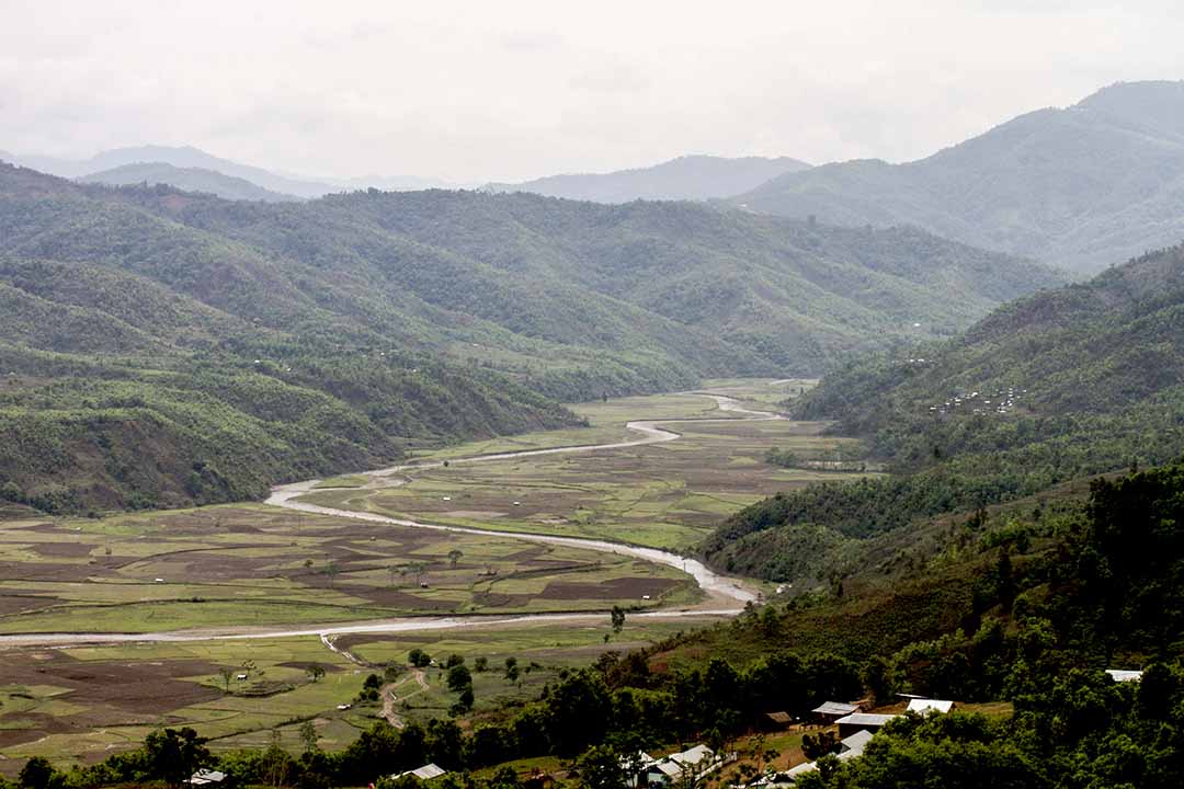
Besides being a part of a hilly terrain or a mountainous region, the state also has an “organic integrity” (see, Part 1). Moreover, this integrity is marked by an intimate network of linkages amongst its internal elements — ranges of mountains/hills, valleys, rivers, and lakes. This “organic integrity” is further made salient as the state is broadly marked out from its immediate neighbours (i.e., Nagaland and Mizoram) in terms of the geographical features.
For instance, the directions of the flows of the major river systems in these states are different (see, Part 1). Correspondingly, the ranges of mountains/hills in the west is higher than those in its eastern ranges in Manipur. Unlike this, in Nagaland, the ranges are higher on their (south) eastern side than those in the western and northwestern sides of the state. Similarly, in Mizoram, the hills are higher on its eastern side.
Incidentally, it is these geographical features which have shaped the critical aspects of the political histories of these states. For instance, the erstwhile Naga Hills (District), which constitute more than half of the total area of the present day state of Nagaland and home of the major tribes in the state, got entangled with the developments in Assam than those of Manipur. This has something to the geographical feature of the erstwhile Naga Hills (District). With its hills lower on its western and northwestern sides — in some areas, the hills abruptly rise from the plains of upper Assam by about 600 m, and then the elevation gradually increases towards the southeastern direction — and most of its major rivers flowing into the Brahmaputra, these geographical features in a way set up the direction of the socioeconomic and political transaction with the plains of upper Assam. Similarly, the erstwhile Lushai Hills (present day state of Mizoram) also got primarily embroiled with the developments in Assam’s Barak region than those in the state of Manipur.
As for Manipur, its involvement with the outside world began, in its known historical periods, majorly with its Southeastern neighbours. Its involvements with the British on the western side, which have shaped its destiny to date, was occasioned by its historical conflicts with the Burmese (on its east and southeastern side). Even the first known “Hindu” idol in the state was believed to be a presentation from its eastern neighbour. These developments are not surprising given that the hill ranges in the east are lower than those on the western side, and the slope the oval-shaped valley is from the north to the south-southeast.
The case of the political history being shaped by geographical features are not unique to Manipur, Nagaland and Mizoram. Expressions like “geo-political” and “geo-strategic” point to the role of geographical consideration in diplomacy and political manoeuvre of the states. A classic example of how politics and political development implicate geographical element is the emergence of Bangladesh —physical separation between the erstwhile “East Pakistan” and the “West Pakistan” being a crucial factor.
Topographical aspects also mediate economic forms of life and economy of the states. The role of having access to the sea in the development of economy of a place and the different kinds of agricultural practices being determined by the topographical features are well known. Similarly, social and cultural geographers remind us that topography has a role in shaping the social life and cultural practices of people in a given geographical space. It is these aspects of geographical mediations that set up the condition for the emergence of “state” in this part of the world. In short, the topography which characterizes the “organic integrity” of the present day state of Manipur shapes its territoriality.
However, this does not mean that the trajectory of this territoriality is unidimensional or fixed across historical periods. That the state is plagued by divisive tendencies today itself is a reminder of that truth. Other elements and forces (e.g., colonial encounter) do impinge on it to give its form, substance and direction. Nonetheless, there is an intelligible topographical condition, and forms of life shaped by the same, that holds and drives the evolution of Manipur as a “state”.
To be continued

The author is a social and political psychologist who teaches social psychology and sociology at the Jawaharlal Nehru University, New Delhi